


World Meteorological Organization Climate Models
Just as an architect might build a scaled model of a building to understand and predict its behaviour, so too the climate scientist can build a computer-based model of the climate system to understand and predict its behaviour. Climate models incorporate the physics of the atmosphere and the oceans and aim to answer questions such as when the next El Niño might occur, and what might happen if greenhouse gas concentrations double.
The challenge for climate models is to run forward in time much faster than the real atmosphere and oceans. To do this, they must make a large number of simplifying assumptions, and perform prodigious numbers of calculations. Various types of models are used to analyse different aspects of the climate. They can be relatively simple one-, two- or three dimensional, and can be applied to a single physical feature of climatic relevance, or they may contain fully interactive, three-dimensional processes in all three domains: atmosphere, ocean and land surface.
Where complicated processes vary according to a wide variety of factors, initially it may be best to explore the processes in one dimension. For example, when looking at chemical reactions that vary with the physical conditions through the depth of the atmosphere, one approach is to look at the reactions at each level from the ground to the top of the atmosphere using average climatic values appropriate to each level. One-dimensional models were initially used for energy-related studies of the climate system. As greater confidence is obtained in way a simple model handles a particular process, the ideas are then incorporated into more complex two- ,three- and four(time)-dimensional representations which incorporate the dynamics of the climate system.
Weather forecasting models must handle the properties of the atmosphere in three dimensions, and work with current analyses of the ocean surface temperatures and at least some basic land surface processes. These models have come to be known as atmospheric general circulation models (GCMs). In parallel, studies of the oceans can concentrate on three-dimensional properties of the oceans and are generally known as ocean GCMs. When it comes to simulating the general behaviour of the climate system over lengthy periods, however, it is essential to use models that represent, and where necessary conserve, the important properties of the atmosphere, land surface and the oceans in three dimensions. At the interfaces, the atmosphere is coupled to the land and oceans through exchanges of heat, moisture and momentum. These models of the climate system are usually known as coupled GCMs.
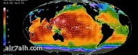
Global climate models (GCMs) for climate
Climate models have been developed from weather forecasting models but for the present use bigger grid spacing and longer timesteps so that they can be run further ahead in time for a given amount of computer time. Without more powerful computers, simulation of the climate with the same detail as in weather forecasts would take far too long, especially if we want to explore many different scenarios of the future. Nevertheless, there is increasing convergence between weather forecasting and climate models, especially for predictions in the range out to months and seasons.
The values of the predicted variables, such as surface pressure, wind, temperature, humidity and rainfall are calculated at each grid point over time, to predict their future values. The time step (the interval between one set of solutions and the next) is a function of the grid size: the finer the resolution the shorter the interval between each computation. A coupled GCM with a 100 km horizontal resolution and 20 vertical levels, for example, would typically use a time-step of 1020 minutes. A one-year simulation with this configuration would need to process the data for each of the 2.5 million gridpoints more than 27 000 times hence the necessity for supercomputers. Even then, there are certain physical processes that act at a scale much smaller than the characteristic grid interval (e.g. clouds and turbulence). Additionally, the complete physics of, for example, clouds would, if computed explicitly at each time step and at every grid-point, swamp the computer. These processes cannot be eliminated, so simplifying equations are developed to represent the gross effect of the many small-scale processes within a grid cell as accurately as possible. This approach is called parameterization and much research work continues to be directed at devising better and more efficient ways for incorporating these sub-grid scale processes into climate models.
Coupled model systems
Coupling the ocean processes to atmospheric GCMs is a major challenge. The thermal capacity of the oceans is massive compared to the atmosphere and can provide to, or extract from, the atmosphere massive amounts of latent and thermal heat. Representing their heat storage, and the absorption of greenhouse gases by the oceans, in long-term simulations of climate requires a full three-dimensional ocean model, which simulates even the deep currents. Changes in the intensity and location of deep-water currents can ultimately have profound effects on the atmosphere. In the past, changes in the circulation of the oceans have produced major atmospheric responses.
The models must also be able to handle shorter-term fluctuations such as those associated with ENSO. Recent developments in climate modelling, which take into account not only surface processes at the ocean-atmosphere interface but also those acting at depth, have produced considerable improvement to the quality of climate model results. An oceanic GCM typically requires very high spatial resolution to capture eddy processes associated with the major currents, bottom topography and basin geometry. High-resolution ocean models are therefore at least as costly in computer time as are atmospheric GCMs. Further coupling of other climate system component models, especially the cryosphere and the biosphere, are also necessary to obtain more realistic simulations of climate on decadal and longer timescales.
Regional Climate Models (RCMs)
Simulating climate change at the regional and national levels is essential for policymaking. Only by assessing what the real impact will be on different countries will it be possible to justify difficult social and economic policies to avert a dangerous deterioration in the global climate. Furthermore, understanding processes on the regional scale is a crucial part of global research. Processes acting on local or regional scales, such as mountain ranges blocking the flow or dust clouds interacting with radiation will ultimately have impacts at the global level.
One technique used to overcome the coarse spatial resolution of coupled GCMs is that of nested modelling. This involves the linking of models of different scales within a global model to provide increasingly detailed analysis of local conditions while using the general analysis of the global output as a driving force for the higher resolution model. Results for a particular region from a coupled GCM are used as initial and boundary conditions for the RCM, which operates at much higher resolution and often, with more detailed topography and physical parameterizations. This enables the RCM to be used to enhance the detailed regional model climatology and this downscaling can be extended to even finer detail in local models. This procedure is particularly attractive for mountain regions and coastal zones, as their complexity is unresolved by the coarse structure of a coupled GCM grid.
- ×

جميع الأوقات بتوقيت جرينتش +3 ساعات. الوقت الآن هو 02:10 صباحًا الأحد 2 أغسطس 2026.
الروابط
الروابط
الروابط
ديموفنف 4
برنامج ديموفمف هو النظرة المستقبلية لبرنامج إدارة المحتوى حيث يمكن أن تلتقي الحاجة مع التقنية والامكانيات
مبرمج ومصمم بآخر تقنيات الانترنت الابداعيةيتجسد به آمال ورغبات تحمل مسؤولية حقيقية لتطوير الانرنت العربي.
مواقع التواصل
الدعم الفني لموقع الرحالة *العبير
Powered by Dimofinf cms Version 4.0.0
Copyright© Dimensions Of Information Ltd.
Copyright© Dimensions Of Information Ltd.